Home > Recorders > Optional Modules > Live Moving Maps
Live Moving Maps
Optional geoDVR Module for Real-time, Map Display of Asset KML Data Along with Aircraft Location for In-mission Situational Awareness
Overview
- Real-time Aircraft/Vehicle/Vessel Position Tracking
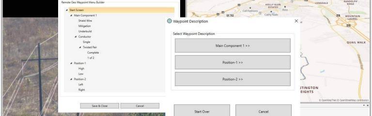
- Load Properly-formatted KML Map Data Files to the geoDVR Map Interface
- Turn On/Off Multiple Map Layers to Depending on the Current Route or Mission
- Turn On/Off the Virtual Map Tilt & Auto-align North Rotations
- Detailed Base Maps Provided for Most Regions
- Works in Disconnected Environments Using our Built-in Offline Map Tile Server
- Additional Camera Target Tracking Available for Compatible Gyro-stabilized Cameras
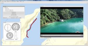
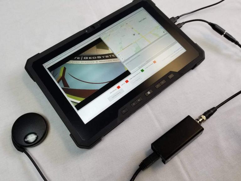
Live Moving Maps is an optional module for the geoDVR offering airborne, vehicle and marine vessel camera operators an “off-line” interactive moving map system synchronized with live video feeds for enhanced mission planning and execution in an intuitive user interface.
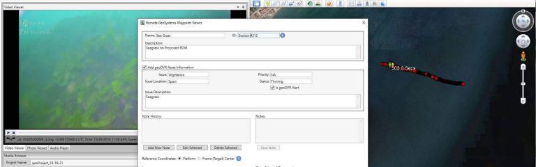
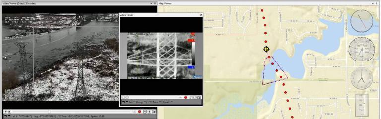
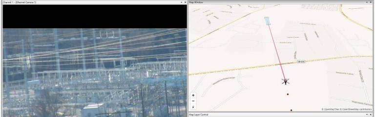
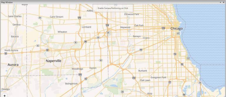
Live Moving Maps can show real-time tracking of the aircraft/vehicle position along with mission-related GIS map data such as KML files of critical infrastructure assets. This functionality is often used to assist in locating and documenting infrastructure assets and places such as pipelines, power line structures, cell towers, wildfire boundaries, wildlife habitats, subject locations and more. Additionally, this makes it easy for camera operators to verbally reference specific asset data such as powerline structure numbers or road names when recording geotagged video and/or audio files.
Live Moving Maps can work with simple fixed-mount video cameras to sophisticated multi-sensor aircraft-mounted gyro-stabilized gimbal systems.
Deployment Options
The geoDVR Live Moving Maps module can be deployed by itself or with additional optional geoDVR modules for even more enhanced mission capabilities.
Stand-alone
Live Moving Maps by itself showing the platform location only is the most common deployment of this module for surface vehicles and aircraft using fixed-mount video cameras and legacy gimbal cameras that are unable to utilize the geoDVR Camera Target Footprint module.
With geoDVR Camera Target Footprint Module
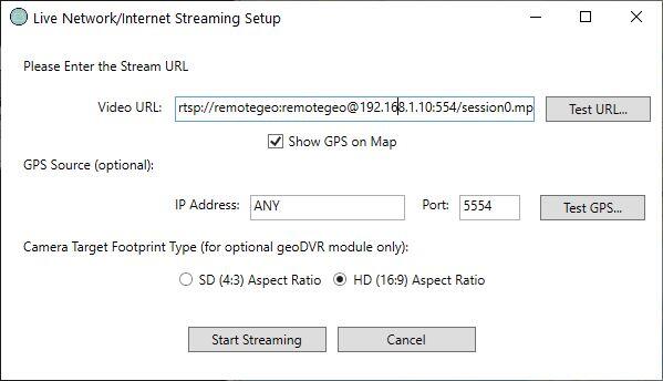
Live Moving Maps can optionally be configured with the geoDVR Camera Target Footprint module for gyro-stabilized gimbal cameras utilizing the Remote GeoSystems protocol. The combination of these geoDVR modules shows a real-time, dynamically-moving “4-corner box” with the camera frame center and field-of-view represented on the map.
Share this page with Colleagues & Clients!
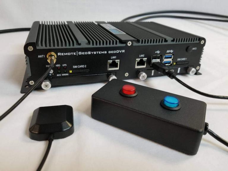
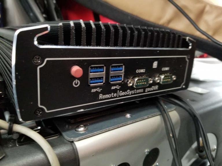
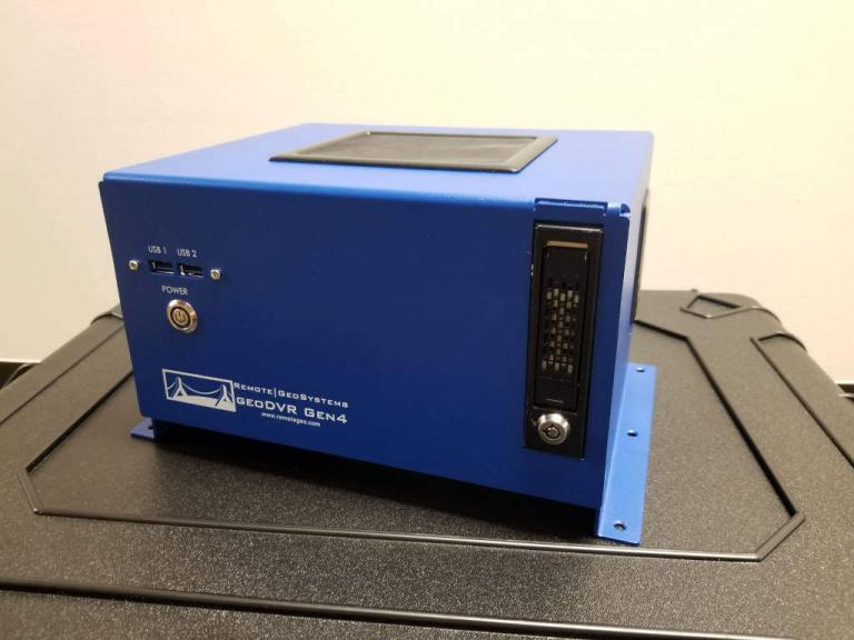
Compatible geoDVR Models
The following geoDVR models offer the optional Live Moving Maps Module.
Other geoDVR Modules
Explore other optional geoDVR modules for enhanced in-flight mission capabilities and metadata capture requirements for a variety of geospatial full motion video data collection applications.