Home > Railway Video Survey & Mapping Solutions
Railway Video Survey & Mapping Solutions
Geospatial Full Motion Video Recorders, Moving Maps and Integrated Mapping Software for Rail Survey, Inspection & Maintenance Operations
Rail transportation networks span thousands of miles/kilometers with ever-changing asset and adjacent wayside property conditions that must be consistently monitored, inventoried and followed up on using GIS (Geospatial Information Systems).
Freight and passenger rail operators, transit agencies, and their contractors are realizing the value of utilizing geospatial or “GPS-referenced” HD video as a powerful, yet very economical tool for specialized and routine track & wayside asset inspections and surveys.
Whether trying to meet 7.2 foot feature location accuracy for Positive Train Control (PTC) requirements or performing routine wayside, track and signal inspections, our geoDVR and LineVision Rail Video solutions reduce costs, risks and on-track time for field engineers and and increase the productivity of back-office GIS teams.
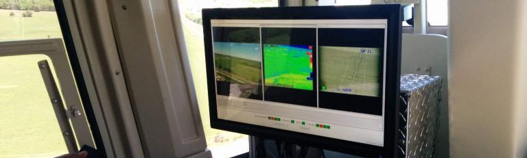
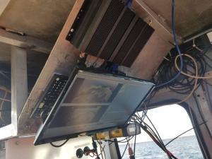
geoDVR Railway Full Motion Video Recorders
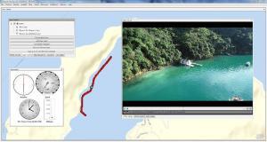
Railway Mission & Project Mapping Software
Proven Video Systems for Railway Video Survey & Mapping
Turn-key Solutions to Record and Map Geospatial Full Motion Video Including MISB FMV / STANAG 4609-spec Video Files from Professional Railroad Survey, Mapping and Inspection Platforms.