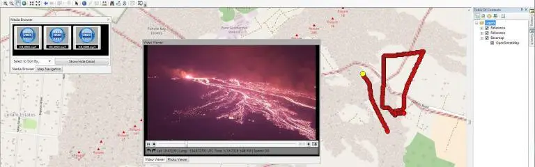
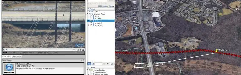
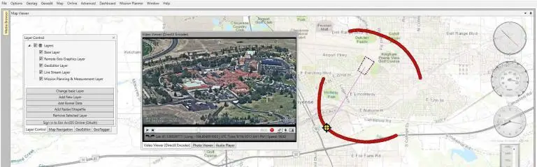
Remote GeoSystems geospatial bridge
  • Software
        • Geospatial Video Survey, Inspection & Surveillance
          • LineVision Desktop
          • LineVision Esri ArcMap Add-In
          • LineVision Google Earth Extension
          • LineVision PLS-CADD Plug-In
          • LineVision Online for Enterprise
          • LineVision geoProject Packaging
        • Video Geotagging, Mapping & Editing
          • Video GeoTagger
          • Video GeoEditor
        • Software Resources
          • Pricing
          • Buy Now
          • FREE Trial
          • Documentation
          • User Forums
  • Recorders
        • Geospatial Video Recorders
          • geoDVR Gen3
          • geoDVR Mini
          • geoDVR Tablet
          • geoDVR Custom Hardware
          • geoDVR for Gimbal Camera Systems
          • geoDVR Installations
          • Request geoDVR Quote
        • Geospatial Audio Recorders
          • geoDSR Tablet
          • geoDSR Mini
          • Request geoDSR Quote
        • Geospatial Recorder Modules
          • Waypoint Keywords
          • Live Moving Maps
          • MISB FMV Metadata
          • Camera Target Footprint (CTF)
          • Nikon Camera Control
        • Recorder Solutions
          • geoDVR Accessories
          • FREE LineVision Software Trial
  • Solutions
    • DJI Drone Solutions
    • Esri GIS Partner Solutions
    • Videogrammetry Solutions
    • Consulting Solutions
  • Platforms
    • Airborne
      • Aerial Power Line Inspection
      • Aerial Pipeline Patrol
      • Airborne Public Safety
      • Airborne Wildlife Survey
      • Aerial News Gathering
      • Aerial Gimbal Cameras
    • Drone / UAV
      • Drones for Utilities
      • Drones for Oil & Gas
      • Drones for Public Safety
      • Drones for Engineering
      • Drones for Transportation
    • Vehicle
      • Survey & Mapping Vehicles
      • Military & Police Vehicles
      • Autonomous Vehicles
    • Rail
      • Rail Asset Video Inspection Systems
      • Positive Train Control (PTC) Video Systems
    • Marine
      • Surface Vessel Video System
      • Subsea ROV Video System
  • Pricing
    • Software Pricing
    • Software Store
    • Purchase Options
    • geoDVR Quote
  • Contact
    • Direct
      • 1-844-436-3877
      • Request a Web Demo
      • Contact Us Form
      • Request LineVision Trial
    • Support
      • FAQs
      • Forums
      • Videos
      • Manuals
      • Terms
    • Social
      • YouTube
      • LinkedIn
      • Facebook
      • Twitter
      • Blog & News
  • Company
    • About
    • Patents
    • Events & Trade Shows
    • Careers
    • News & Info
      • Newsletter Archive
      • Press Releases
      • In the News
    • Government Codes

LineVision Google Earth Extension

Previous
Next
LineVision Google Earth Logo
Software for Professional Video & Photo Playback, Analysis and Project Reporting with GIS-compatible Maps and Data Sources
Try It
Buy It

LineVision Google Earth Extension

LineVision™ Google Earth Extension is a simple tool for interactive, “click-on-track” geotagged video & photo playback, analysis and project reporting using Google’s popular globe software as a 3D terrain base mapping application.

View your aerial and mobile video mapping missions as 3D “tracks” in Google Earth taking into account platform altitude and terrain. Click any point along the path to geographically “fast-forward” or “reverse” the video to that exact location.

This easy-to-use software is one of the most “open” and versatile geospatial video analysis tools available. Easily playback properly formatted geo-referenced video files from a variety of consumer video cameras, drones, gyro-stabilized video systems and specialized geospatial DVRs, including our own geoDVR hardware

Now even those without GIS experience can easily view this valuable asset location-based multimedia using enterprise maps & data provided in KML format.

Put Geospatial Video and Media on Google Earth with LineVision

  • Map-based Playback of Geo-referenced Video Files
  • Multi-channel HD & SD Video Viewing
  • Viewing of High-resolution Oblique Still Photos
  • Snap & Save Geo-tagged Photos from Video
  • Add & Edit Documents and Files Right on the Map
  • Add local KML Files & Streaming Raster Satellite & Aerial Imagery
  • Compatible with Video from Commercial Drones & UAS
  • Connect to Enterprise GIS Map Services Online
  • Open & Create Portable geoProject Packages
  • And more…

Free Trial

We want to make sure you have the right software for your project needs and offer a full-featured 7-day trial of our LineVision Desktop products.

Request Trial

LineVision Google Earth Extension Videos

Play Video
More Videos

Mulitple Editions for Various Workflows

LineVision Google Earth is available in Basic and Professional editions. The main difference between the two versions is Professional will allow you to create, save and update interactive, immersive geoProject reports with all related geotagged videos, photos, documents, KML files and other map data. Basic edition is primarily designed for viewing and interacting with geoProjects previously created and saved in one of the LineVision Professional or Ultimate editions.

Compare Editions

Pricing - LineVision Google Earth

Basic

Interactive Viewing & Analysis
$24
$ 20
75
per month w/ annual plan
  • $24 - Monthly
  • $249 - Annual
  • $500 - Perpetual
  • Enterprise Licensing - Call
BUY NOW

Professional

Build, Save & Update geoProject Deliverables
$39
$ 33
25
per month w/ annual plan
  • $39 - Monthly
  • $399 - Annual
  • $1,000 - Perpetual
  • Enterprise Licensing - Call
BUY NOW

Details - LineVision Google Earth Extension

Features
Specifications
Requirements
Features

Below are some of the most essential features in the LineVision Google Earth Extension. For a more complete list of features and capabilities please check out the edition comparison table.

Video

  • Supports for high-definition and standard definition (NTSC & PAL) video files
  • Single camera map-based video playback
  • Multi-camera map-based video playback (up to 4 geo-synchronized files)
  • Navigate video by GPS waypoints (when applicable)
  • Navigate video by latitude/longitude coordinates
  • Chain together multiple geospatial video segments for continuous playback
  • Set custom geo-fence radius for moving platform on mission route
  • Extract GPS data from video (geoDVR or “Whisper” videos only)
  • Export waypoints from video as a GPX file
  • Show and trace estimated camera projection
  • Create MISB FMV from geotagged video

Photos

  • Load oblique photos
  • Geotag or re-geotag photos
  • Snap and save geotagged digital still images from videos
  • Manipulate photos

Audio

  • Listen to audio from the video files

Annotations & Documents

  • Geotag & update annotations on the map
  • Geotag & update documents and files on the map

Mapping

  • Load KML/KMZ files
  • KMZ to KML Converter
  • Show terrain, borders, roads, buildings, current location, latitude/longitude status bars
  • Load GPS & Waypoint files with and without video

Compatible Video Cameras

  • COTS (consumer-off-the-shelf) video cameras like Garmin ViRB, ContourGPS and some Sony POV & Handycam models
  • Commercial and professional Drones like the DJI Inspire and Phantom Pro series UAVs
  • Airborne multi-sensor gyro-stabilized systems connected to a geoDVR or other compatible GPS-enabled DVR
  • Multi-camera mobile mapping vehicles using a geoDVR or other compatible GPS-enabled DVR

Reporting & Data Portability

  • Save your data fusion and analysis work reports as a .geoProject file for easy collaboration, data portability and simple delivery to clients and end-users with LineVision

Interface

  • All panels are movable and can be “floating,” “docked” and resized
  • Customize and save preferred layout and application settings
Specifications
Geospatial Video File Support
  • Video File Format: .MP4, H.264, .AVI, .TS, .MOV, .ASF, .PS, .VOB, .MPG4, .MPEG4, .MP2, .MPG2
  • GPS Companion File Format: .GPX, .FIT, .SRT (DJI drones), .RGPS, .CSV, KML, .TXT, .LOG, .MOFF (Sony action cameras), .XML (Cloud Cap Technology, Red Hen Systems)
  • Embedded GPS Metadata: MISB FMV, DJI GPS in Closed Captions, Remote GeoSystems “Whisper” (Persistent GPS Encoding)

  • Geospatial Photo Support
  • JPEG: GPS metadata in EXIF header

  • Geospatial Map Data Support
  • KML/KMZ files

  • Geospatial Project Packaging
    Single PC, Local Network or Portable Drive:
  • Remote GeoSystems .geoProject file
  • Portable Project File:
  • Remote GeoSystems .geoProject “Uncompressed” file
  • Remote GeoSystems .geoProject “Pack & Go” .RGS file (similar to a zip file)
  • Requirements

    LineVision Google Earth editions are supported on Microsoft Windows Operating Systems versions XP, 7, 8 & 10.

    Recommended PC Specifications

    • Processor: Intel Core i7 or better
    • Ports: (2) USB 3.0
    • RAM: 8GB Minimum, (Windows 7, 64 Bit or better)
    • Hard Drive: 1 TB Minimum (or more depending on recording length. Ample storage is recommended as video files can take considerable space).
    • Video Card: minimum of 1 GB of memory

    Minimum PC Specifications

    • Processor: Intel Core i3 or better
    • Ports: (1) USB 2.0
    • RAM: 4GB Minimum
    • Hard Drive: 320 GB Minimum (or more depending on recording length. Ample storage is recommended as video files can take considerable space).
    • Video Card: minimum of 1 GB of memory

    Get a Demo

    Want to learn more about how the LineVision Google Earth can add value to your video survey, inspection and surveillance projects? Request a customized web demonstration!

    Request demo

    Frequently Asked Questions (FAQ)

    (click below to expand)

    LineVision Google Earth Extension

    a

    I need to be able to show video and my flight route on a Google Map or Google Earth in real time as the video plays. Is this something your software can do?

    Yes – Our LineVision software allows you to view video files with continuous GPS coordinates a map for dynamic an interactive playback along a flight route. The LineVision Google Earth Extension lets you do this with Google Earth and our LineVision Desktop lets you do this with Esri ArcGIS Maps.

    Categories: Drone & UAV FAQ, General LineVision FAQ, LineVision Desktop, LineVision Google Earth Extension
    Back to Top
    a

    Does the LineVision Google Earth Extension work with both Google Earth Pro and Standard?

    Yes.

    Category: LineVision Google Earth Extension
    Tag: Google Earth
    Back to Top
    a

    How is your LineVision software licensed?

    LineVision Desktop, Add-ins, Extensions and Plug-in software is currently licensed to a specific PC as a monthly, annual or perpetual license plan.

    The perpetual and includes free updates for the first year and an optional 20% annually for upgrades in year 2 and beyond. Click here to see our pricing plans.  

    Categories: General LineVision FAQ, LineVision Desktop, LineVision Esri ArcMap Add-in, LineVision Google Earth Extension, LineVision PLS-CADD
    Back to Top
    a

    How do I get a single geotagged video to play in LineVision?

    To load a single geotagged video to LineVision go to File > Open Video then navigate to Windows folder where you downloaded the geotagged video AND GPS “companion” or “sidecar” files. This should load up the video and play with the clickable GPS track on the map.

    Check out this short tutorial:

    Categories: General LineVision FAQ, LineVision Desktop, LineVision Esri ArcMap Add-in, LineVision Google Earth Extension, LineVision PLS-CADD
    Back to Top
    a

    Can I save files or projects so that users do not have to manually select and add the videos, photos and other files needed to view a project?

    Yes. You can save your project as a geoProject. That way end user only needs to open the geoProject, view and interact with the project deliverable as you last saved it.

    Categories: General LineVision FAQ, LineVision Desktop, LineVision Esri ArcMap Add-in, LineVision Google Earth Extension
    Back to Top
    a

    How can I share the videos I will make with LineVision with my clients? Will they also have to buy the LineVision software to view my content?

    The geoProject format is the ideal way to deliver an interactive and immersive map-based deliverable to your client. (Click here for more on geoProjects.)

    However, to offer that type of functionality, requires software that make that all work together.

    If you are using the Remote GeoSystems geoProject format for your deliverable, then your client will need some sort of version of LineVision Basic edition or higher to view the saved geoProject.

    This can be any of the following LineVision versions: LineVision Google Earth Extension, LineVision Desktop, LineVision Esri ArcMap Add-in or LineVision Online for Enterprise.

    Since we do offer the monthly plans, so you could subscribe for your client and turn off their subscription for the months that its is not being used.

    Alternatively you could create screen capture of the LineVision running if you just needed to send your client a movie. There are also the automated reports that can be exported in Microsoft Word and Excel, as well as mission plans that can be exported as KML files. But again, the map interactivity with video requires the LineVision software currently.

    Categories: Drone & UAV FAQ, General LineVision FAQ, LineVision Desktop, LineVision Esri ArcMap Add-in, LineVision Google Earth Extension, LineVision Online for Enterprise, Marine & Subsea FAQ
    Back to Top
    a

    Do you have a published standard CSV format so I can be sure my geospatial video GPS data companion files are compatible with LineVision?

    Yes. LineVision accepts many different GPS Data companion file types and to make it easy we have a published very simple CSV spec for LineVision.

    The format is as follows:

  • Column 1: Latitude
  • Column 2: Longitude
  • Column 3: Altitude
  • Column 4: UTC Time
  • Column 5: Speed
  • Column 6: Course
  • The 1st row MUST be the following:

    LATITUDE, LONGITUDE, ALTITUDE, UTCTIME, SPEED, COURSE

    From there, each additional row just needs to be the corresponding values.

    You can download the Simple CSV file format example by clicking on the document title below.

    Remote GeoSystems LineVision Sample CSV Format (Simplest)

    Categories: Drone & UAV FAQ, General LineVision FAQ, LineVision Desktop, LineVision Esri ArcMap Add-in, LineVision Google Earth Extension, LineVision Online for Enterprise, LineVision PLS-CADD
    Back to Top
    < Back to Software

    1-844-436-3877
    Send Us An Email
    Subscribe to Newsletter
    Esri Silver Partner Logo

    ©2011 - 2022 Remote GeoSystems, Inc.

    Sitemap | Privacy Policy | Terms/Conditions

    U.S. Patent No. 9,936,214; 10,516,893; 10,893,287; other patents pending


    3307 South College Avenue | Suite 211 | Fort Collins, CO 80525 | USA

    Any reference to other company, product and/or service names used in this web site are for identification purposes only. All trademarks, registered trademarks and copyrights are the property of their respective owners.