

Home > Mapping Software > LineVision Online
LineVision Online
Web-based Geospatial Full Motion Video & GIS Data Mapping Software
Consolidate Field Data Into Actionable Geospatial Intelligence
Organizations today have numerous platforms for collecting massive volumes of location-based videos, still photos, map data, notes and other sensor data - but struggle to organize, analyze, share, and most importantly, take necessary actions effectively.
LineVision Online solves this with an off-the-self and customizable enterprise software platform for mapping, managing and creating work products and multimedia that save time, reduce risks and ultimately increase revenue and operational efficiency.
LineVision Online integrates with traditional Esri GIS tools and file-based workflows to deliver a unique interactive map-based experience for all potential users within an organization from field workers to C-suite executives to external stakeholders.
What Can LineVision Online Do for Your Project Workflow?
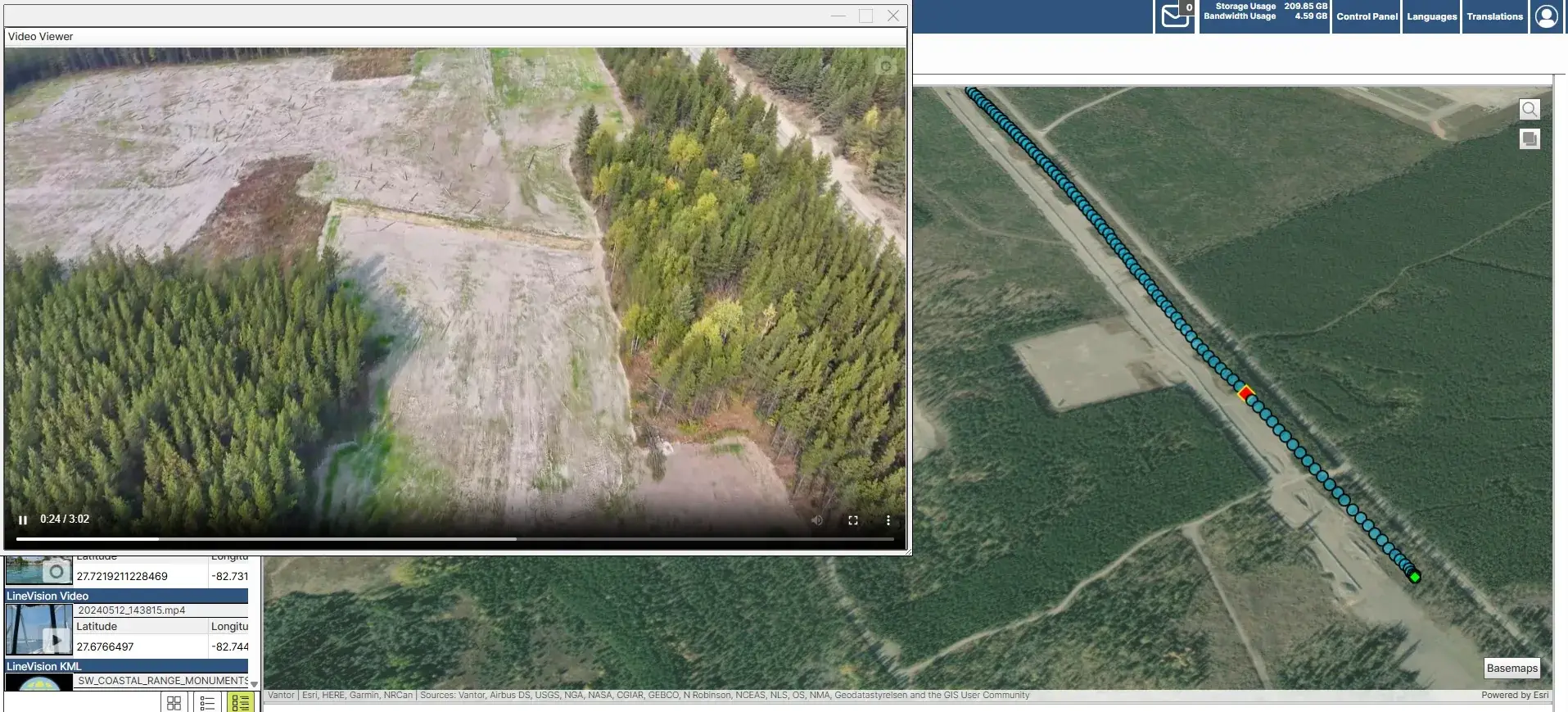
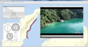
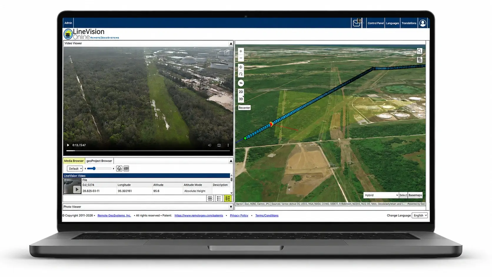
Map Video
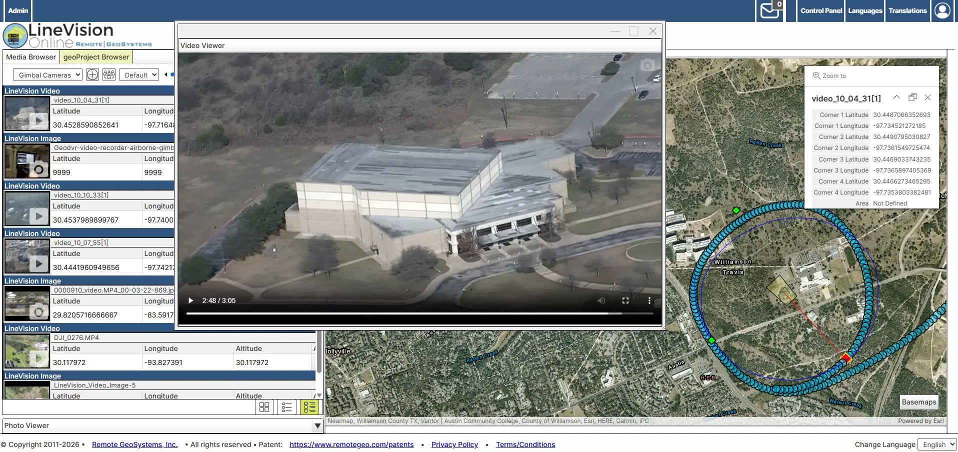
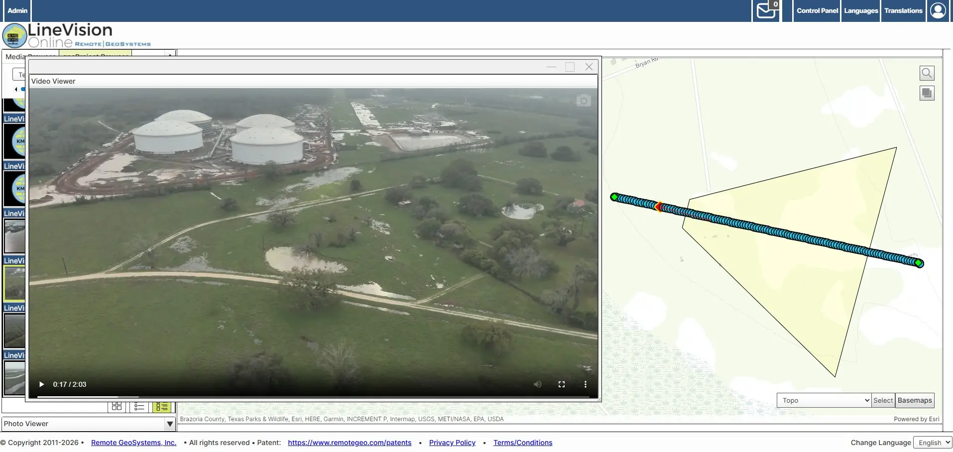
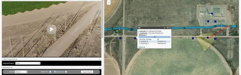
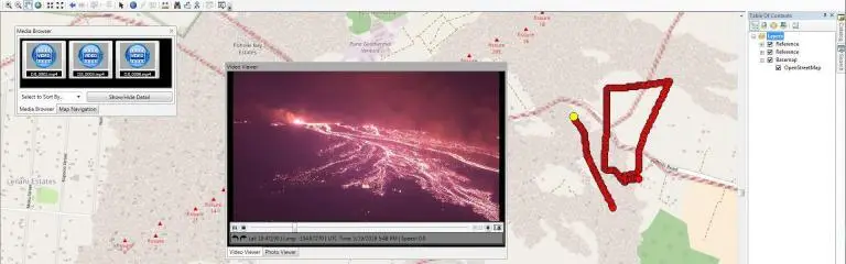
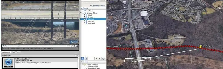
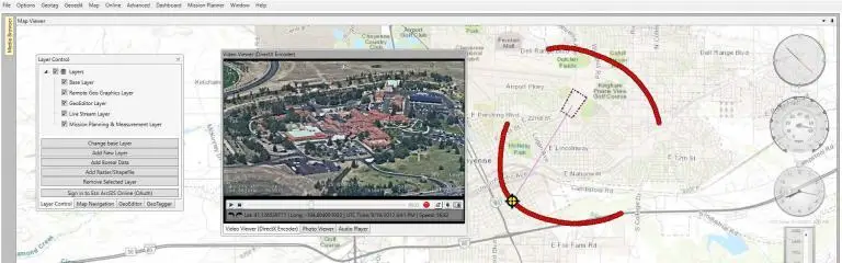
Now teams can easily see exactly WHERE and WHEN each frame of video was captured with reference to enterprise field asset data and the surrounding environment.
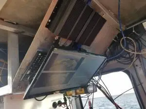
LineVision Online is camera and platform-agnostic, offering the broadest range of support for different geotagged full motion video formats collected from drones, manned aircraft, vehicles, marine vessels, subsea ROVs and hand-held devices.

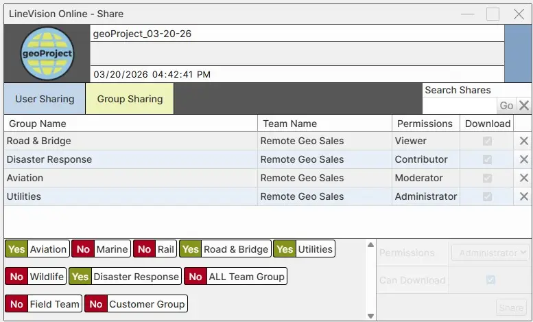
Share & Collaborate
Apply specific user privileges to each shared dataset such as viewer-only, contributor, moderator or administrator.
Organize geoProjects
Easily share these interactive geoProjects with various teams, stakeholders and clients in the LineVision Online interface or upload/download via LineVision Desktop and Google Earth versions.
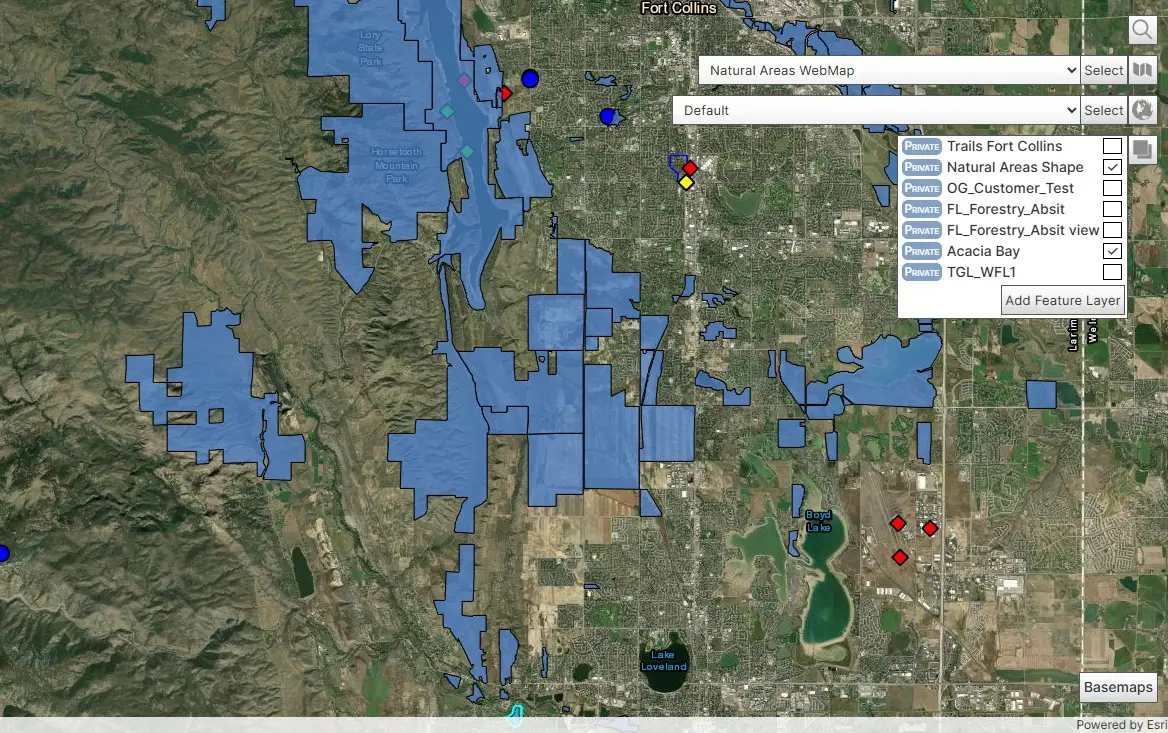
Integrate GIS Data
Users can leverage KML, Esri base maps and ArcGIS Online Feature Layers, Web Maps and Web scenes to put field media in the right geospatial context.
Deploy Your Way
LineVision Online offers Professional and Team editions as a hosted Saas, while Enterprise deployments are available in a dedicated cloud, on-premise appliance or client-managed data center.
Geospatial Video Mapping
LineVision Online supports the interactive playback and live streaming of a wide range of georeferenced video and telemetry formats - not just MISB FMV/STANAG-spec full motion video - making it easy to leverage geotagged video from most drone, aircraft, vehicle, marine and specialized gimbal camera systems.
geoProject Organization
Combine and organize related multi-source geospatial media such as videos, photos, notes/annotations/files and map data as portable geoProject deliverables. Easily share these interactive geoProjects with various teams, stakeholders and clients in the LineVision Online interface or upload/download via LineVision Desktop and Google Earth versions.

Secure Sharing & Collaboration
Collaborate more efficiently with internal teams, field crews and trusted contractors by securely sharing media items and geoProject collections with individual users and predefined groups of users. Apply specific user privileges to each shared dataset such as viewer-only, contributor, moderator or administrator.
Catalog, Store & Archive
Leverage your enterprise maps and imagery provided by Esri ArcGIS other OGC-compliant web map services.
GIS Integration
Leverage your enterprise maps and imagery provided by Esri ArcGIS other OGC-compliant web map services.

Share this page with Colleagues & Clients!
Features & Capabilities
LineVision Online offers enterprise organizations the most robust set of centralized, permissions-based distributed group sharing of interactive geospatial full motion video, photos, notes, documents and reporting capabilities for survey, inspection and surveillance.
(Click to expand. Features vary by edition)
- Playback and View GPS-linked Videos, Photos & Audio on Maps
- Navigate Video by Clicking on Map GPS Tracks & POI Waypoints
- Support for Numerous Video & GPS Data File Formats
- Simultaneously Playback up to 4 Videos from the Same Platform
- GPS-enabled Action Cameras like GoPro, Garmin, Sony and More.
- Multi-Sensor Airborne Gyro-stabilized Gimbal Camera Systems
- geoDVR Geospatial Video Recorders & Compatible DVRs
- Drones, Subsea ROVs and other Remote Sensing Video Systems
- MISB FMV Spec Videos with KLV Encoded Metadata
- Remote GeoSystems Spec Camera-Target-Footprint (CTF) Videos
- Easily Prepare DJI Drone Metadata for Esri’s FMV Multiplexer Tool
- Create, Save and Share geoProjects for other LineVision Versions
- Interactive Map Interface Leveraging Esri GIS
- Esri-based Streets, Imagery, Topo & Oceans Base Maps
- Add Shapefiles & Raster Imagery and supported KML
- Stream Maps from ArcGIS Enterprise & ArcGIS Online
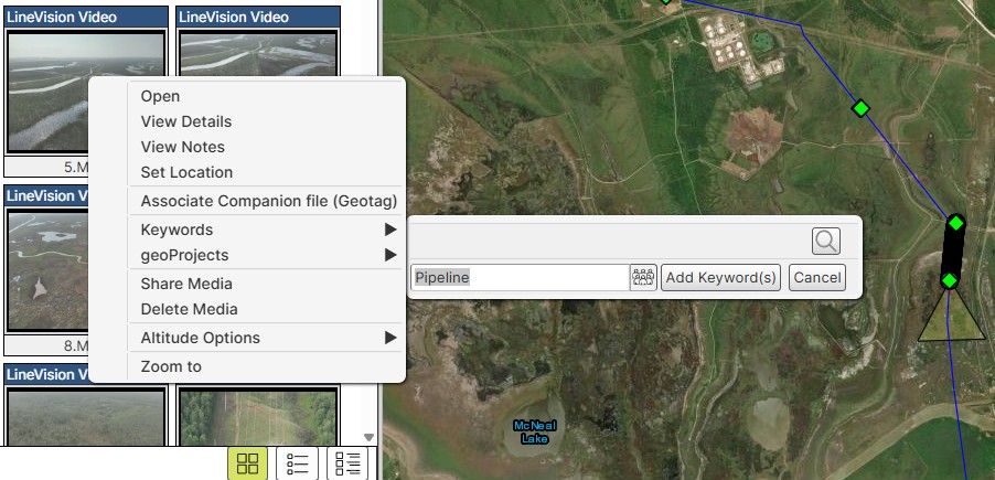
1. Add Metadata & Descriptions to Videos, Photos, POIs & More
2. Attach Notes & Files to Map Locations
3. Available Support for 3rd-Party Remote Sensing Data Systems
- Industry-leading DJI Drone Data Mapping & GIS Integration
- Military UAVs Using the MISB FMV/STANAG KLV Spec
- Gimbals Using the Remote Geo Camera-Target-Footprint Spec
- Specialized Subsea ROV Underwater GPS Systems
Multiple Editions
LineVision Online Pricing & License Plans
LineVision Online is offered in Monthly, Annual and Enterprise license plans. Purchase and create a Professional or Team account now at our online store for a hosted account or contact us for Enterprise pricing and deployment options.
(Clicking Buy Now will take you to our shopping cart for secure checkout)
Professional
- 1 Individual User Account
- Individual Media Item Sharing
- Individual geoProject Sharing
- 125 GB Bandwidth
- 250 GB Storage
- Add Storage as Needed
- Add Bandwidth as Needed
Team
- Everything in Professional Plus+
- 5 Team User Accounts
- Team User Management
- Group User Management
- Unlimited Groups
- Group Media Item Sharing
- Group geoProject Sharing
- Branded Login Page
- 500 GB Bandwidth
- 1000 GB Storage
- Add Team Users as Needed
- Add Team Storage as Needed
- Add Team Bandwidth as Needed
Enterprise
- Everything in Team Plus+
- Installed On-premise or Your Enterprise-managed Cloud
- License-defined User Accounts
- Client-defined Storage
- Client-defined Bandwidth
- Developer APIs Available
- Live Video & GPS Streaming Available
Flexible Deployment Options
Hosted SaaS
LineVision Online Professional and Team editions are available as monthly or annual SaaS subscriptions, eliminating the need for upfront licensing and infrastructure commitments. Easily add or reduce user, storage and bandwidth packages to quickly adjust to changing project requirements.
Dedicated Cloud
Remote GeoSystems can deploy LineVision Online Enterprise in a dedicated AWS cloud instance, providing organizations with a secure and highly available environment that can easily scale up or down to accommodate changing computing power, storage and bandwidth requirements.
On-premise Appliance
Remote GeoSystems can deliver the LineVision Online Enterprise application on powerful server-grade hardware with substantial storage capacity in a robust portable case for easy setup, elimenating a lengthy hardware acquisition, setup and configuration process.
Client Data Center
Remote GeoSystems can work with a client's IT department to specify the appropriate hardware and equipment requirements for running the LineVision Online Enterprise application server and data storage behind the firewall in a client-managed data center.
Customer Success with LineVision Online
LineVision News & Updates
Check out the latest LineVision related news and updates from Remote GeoSystems.

Ready to Get Started?
Schedule Demo
Buy Now
Related Software
Check out related professional LineVision software options that support the Remote GeoSystems “geoProject” deliverable format – as well as our consumer Video GeoTagger / Video GeoEditor applications.